EVA Vale do Itajara
Location: Estrada do Secretário, Vale do Itajara, Pedro do Rio, Petrópolis, RJ, Brazil
Year: 2022
Stages: Environmental Feasibility Study (EVA)
Area: 143 ha
Work themes: Natural Regeneration of Native Vegetation of the Atlantic Forest, Nature-Based Solutions (SbN), Green Infrastructure, Ecological Corridors, Slope Protection
Typology: Private enterprise
Client: Inti Empreendimentos Imobiliários Ltda
Collaborators: Def Architecture and Urbanism
Summary
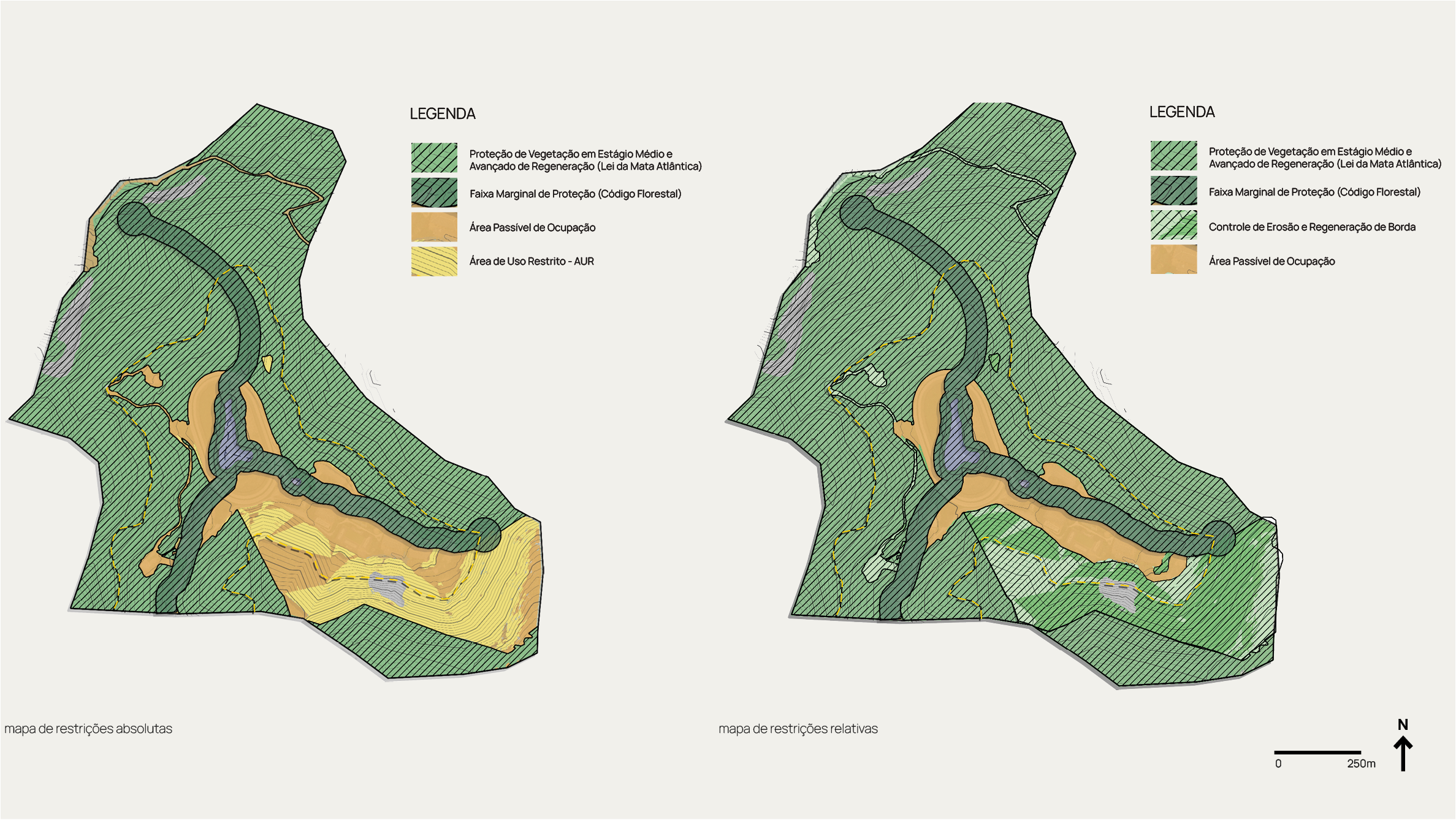
Development of Environmental Feasibility Study (EFS) for land located in the district of Pedro do Rio, in the municipality of Petrópolis. Its main objective was to present, graphically, through maps, texts, and diagnostics, the restrictions and possibilities of land use and occupation to assist the client in decision-making regarding its occupation, with a focus also on environmental preservation and sustainable practices, aiming to mitigate the impacts of future intervention in order to protect the most vulnerable environmental areas, preserve and enhance habitats, and identify obstacles to the environmental licensing process, so as to define changes in the project or its location.
The Project
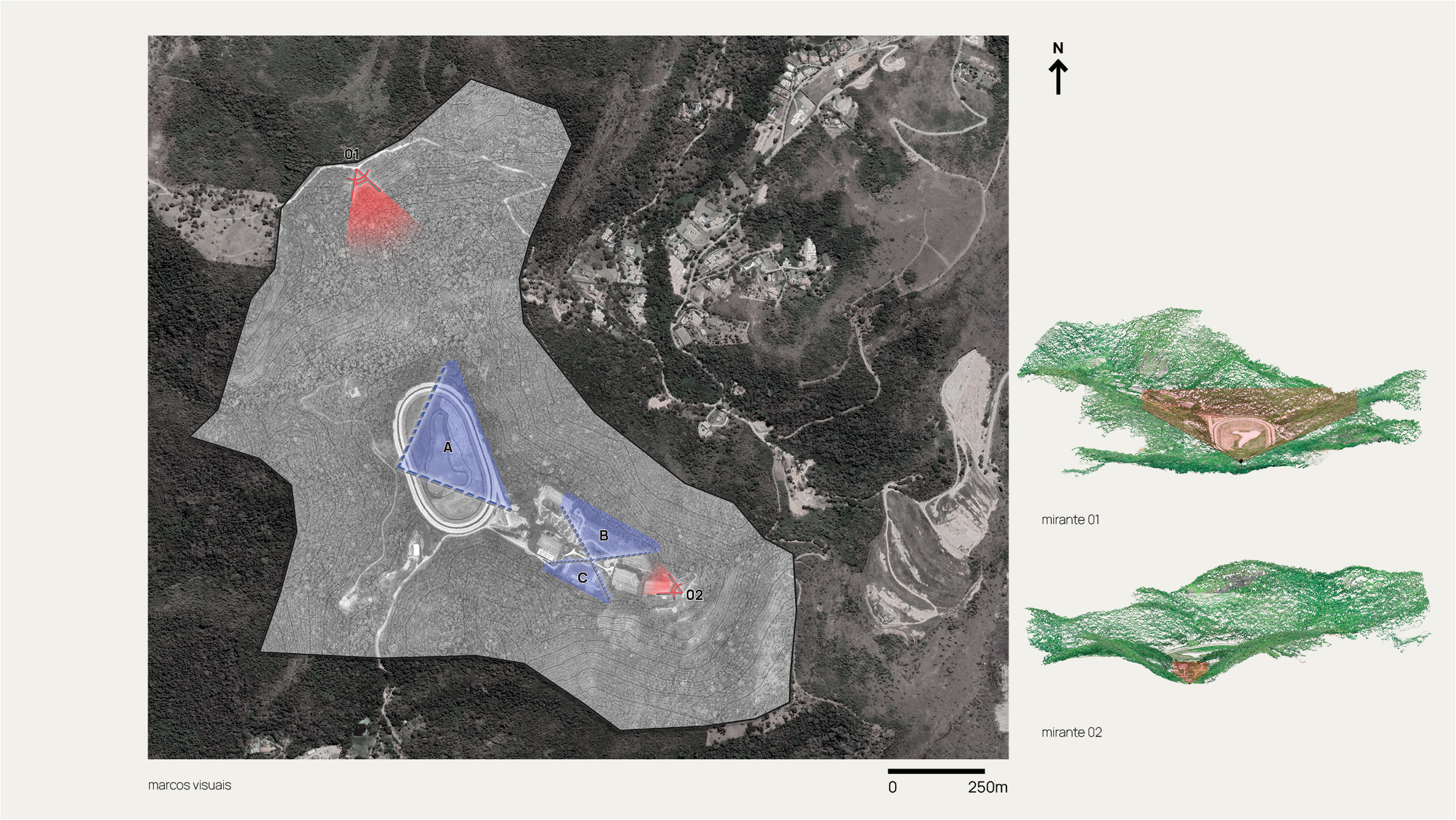
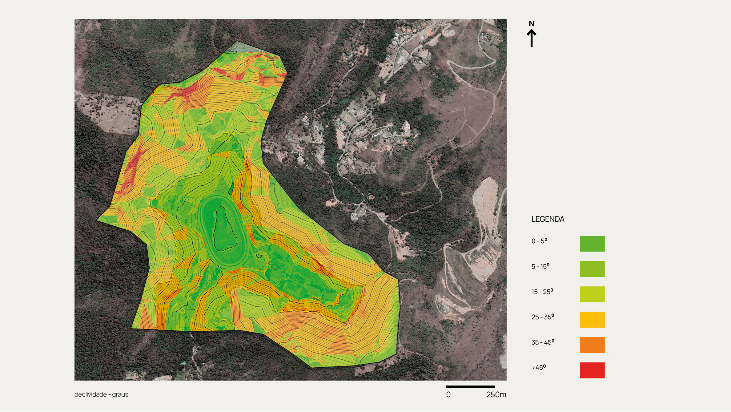
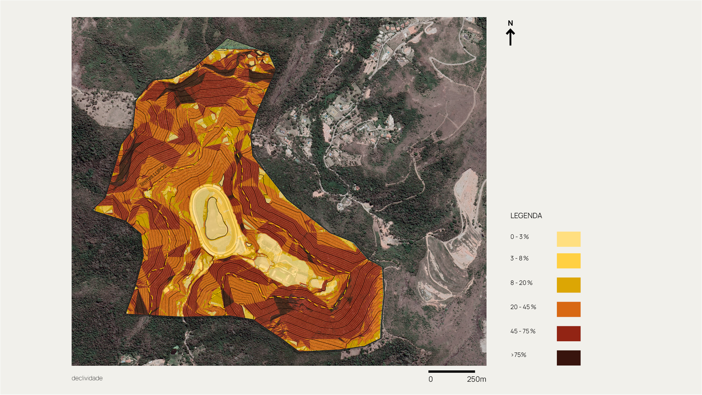
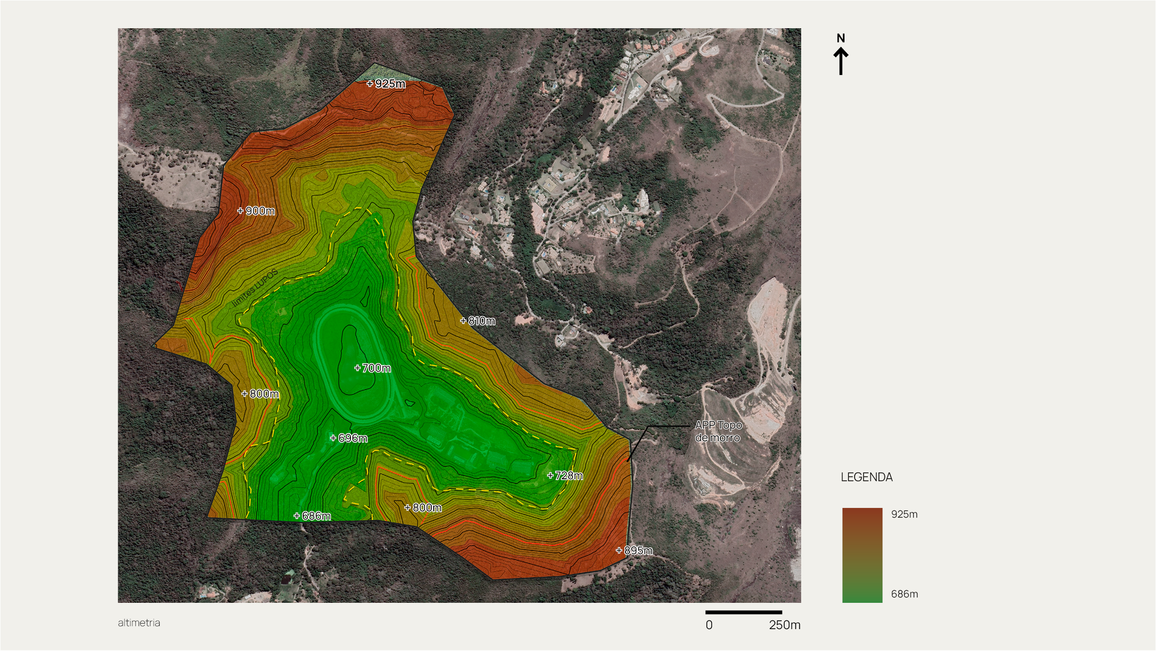
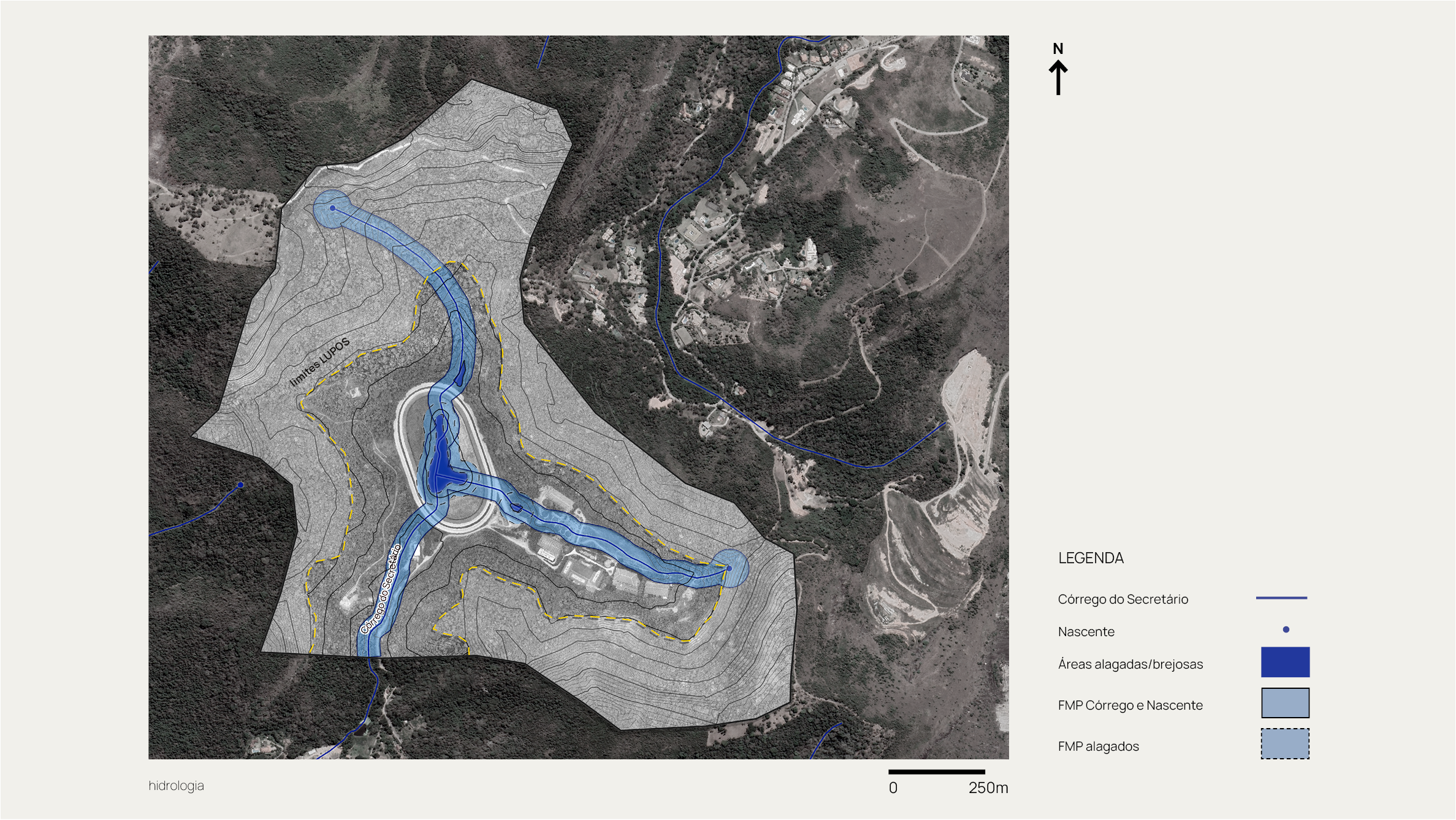
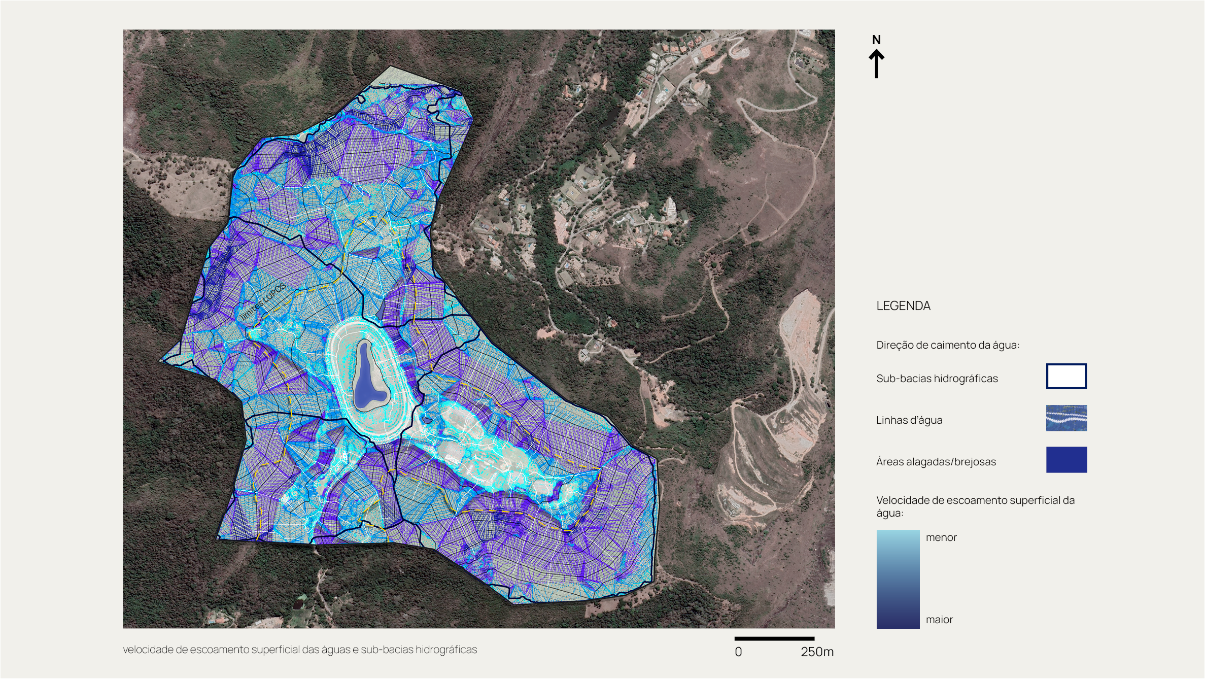
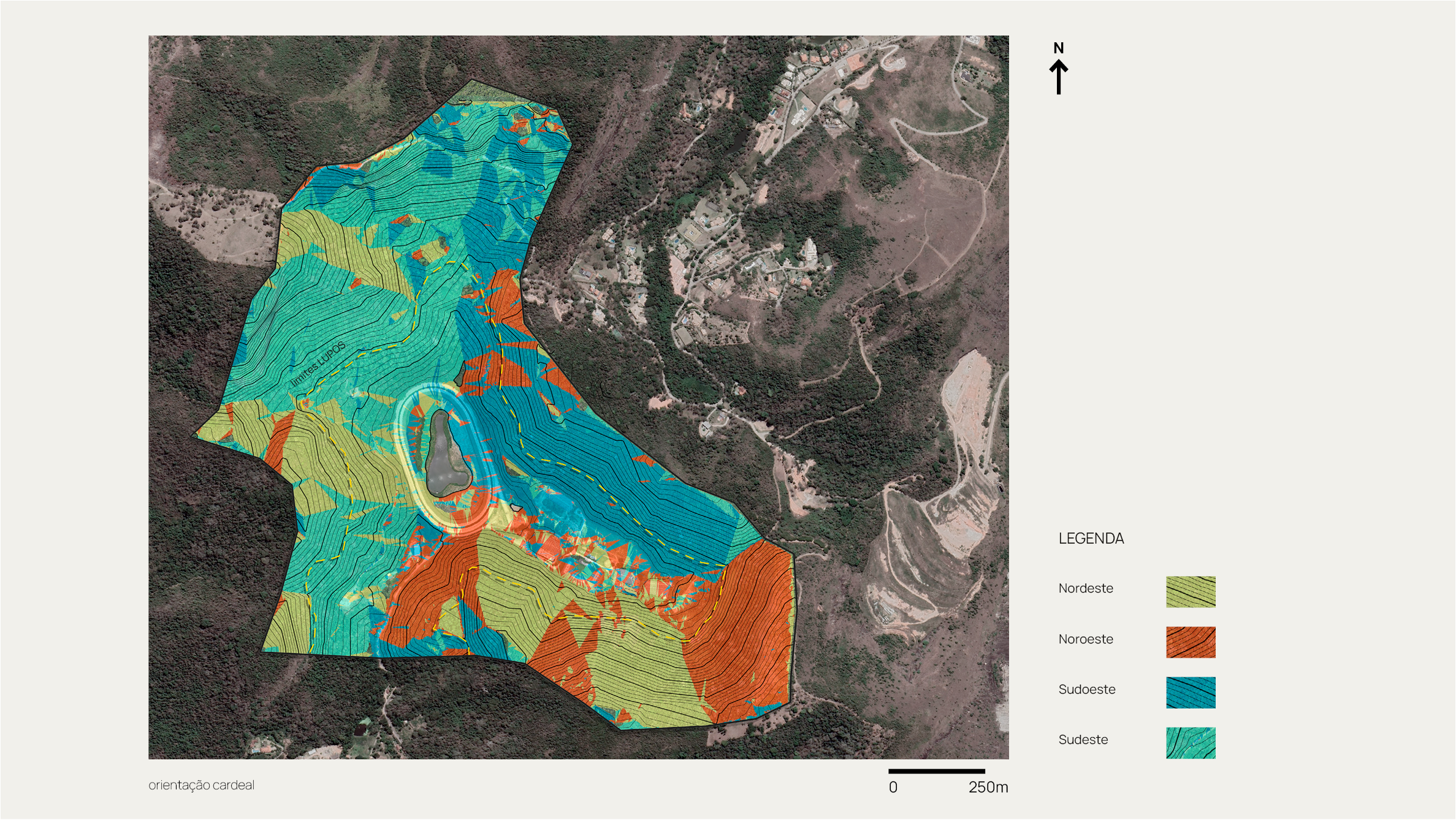
The study presents a series of analyses on geomorphology, slope, altitude, hydrography, among other characteristics of the land. The overlay of all these data resulted in an environmental diagnosis of the area, where we present absolute restrictions and, through our perspective on the landscape, also present relative restrictions that aim for greater protection and assist in the process of ecosystem recovery and integration.
Additionally, a general overview of the urban legislation applicable to the property boundaries was presented, as well as its occupancy history and a detailed floristic diagnosis with the botanical identification of the main species found on the land, the evaluation of their regeneration stage, and the identification of possible endangered species.
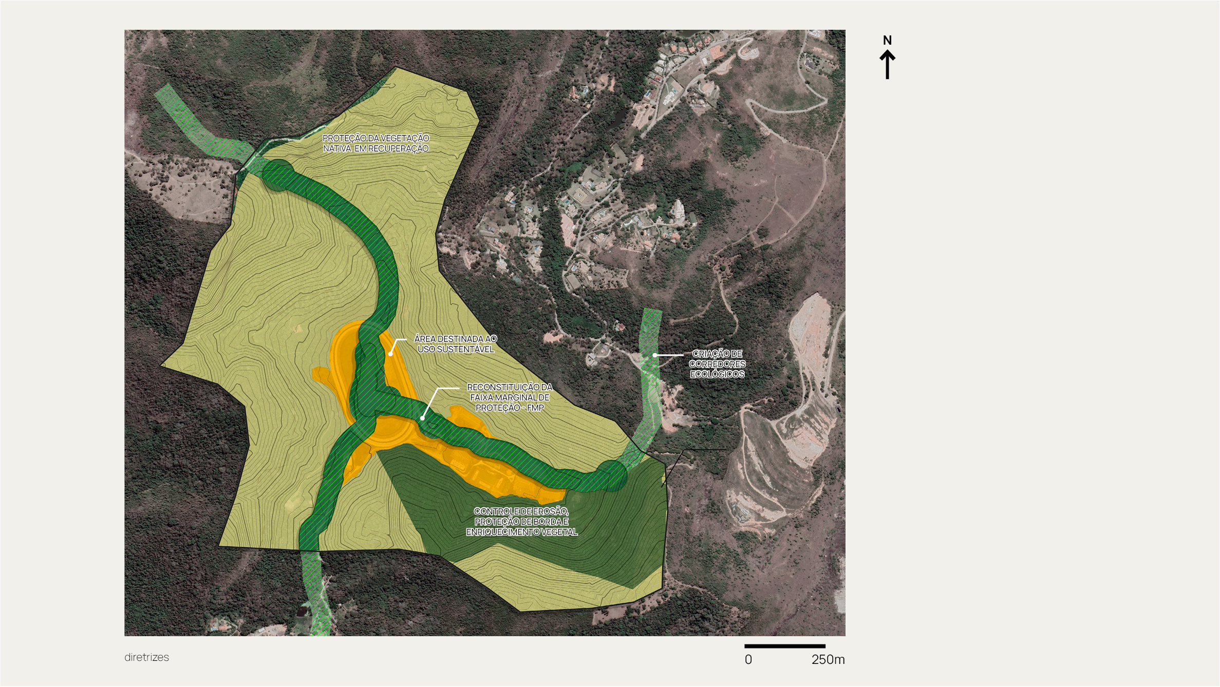
The final stage of the work consisted of presenting environmental guidelines aimed at mitigating the impacts of future occupations in a harmonious and integrated manner with the architectural and urban planning project. Recommendations for the short, medium, and long term were also presented, with the basic principles of preservation, conservation, recovery, and restoration of the local ecosystem.
Goals and Results
Green corridors
93,000 m² of restoration of the marginal protection strip
Regulation of weather events
50,000 m² of edge protection and erosion control through reforestation